


 Tech
Tech
Banasura Sagar Dam, Wayanad: A Complete Travel Guide
Banasura Sagar Dam in Wayanad, Kerala is India's largest earthen dam. Guide to timings, entry fees, boating, islands, trekking and the best time to visit.
29 August 20266 min read
Banasura Sagar Dam: An Overview
Banasura Sagar Dam stands at Padinjarathara in Wayanad district, Kerala, around 21 kilometres from Kalpetta town. The embankment crosses the Karamanathodu, a small hill river that feeds the Kabini, and holds back a reservoir spreading through the valleys below the Banasura hills. It is commonly described as the largest earthen dam in India and the second largest in Asia.
The structure was raised for power generation, irrigation, and drinking water supply, but the reservoir has grown into one of the busiest stops on the Wayanad travel circuit. A landscaped hydel park at the foot of the dam, boat services on the water, and the walk up to the viewing area on the embankment make up a typical visit, which most travellers complete in two to three hours.
History and Purpose
Project Background
The dam belongs to the Banasura Sagar Project, planned to strengthen hydroelectric generation in the Kuttiyadi river system on the western side of the Ghats. Rather than driving turbines at the dam site itself, the reservoir stores monsoon runoff and transfers it westward under the Kuttiyadi Augmentation Scheme, supporting the Kakkayam hydroelectric power project downstream. Alongside power, the stored water eases irrigation and drinking water shortages in the surrounding panchayats during the dry months. The reservoir is operated from the Padinjarathara station of the Kerala State Electricity Board.
Project Timeline
- 1979: Construction work on the Banasura Sagar Project began at Padinjarathara
- 1980s and 1990s: The main embankment was raised along with a set of saddle dams closing low points around the reservoir rim
- 2004: The project was completed and the reservoir brought into regular operation
- 2016: A 500 kWp floating solar plant, among the first installations of its kind in the country, was commissioned on the reservoir surface
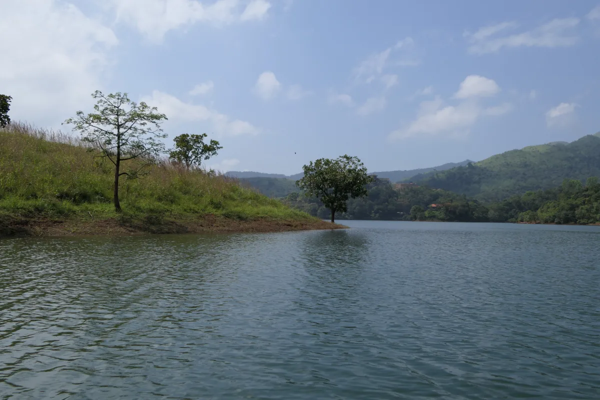
Water spread at the reservoir shifts noticeably through the year because storage and release depend on rainfall. The island cluster that draws most photographers is at its most striking when levels sit high after the monsoon, and shrinks as the water drops through the dry season.
Engineering and Specifications
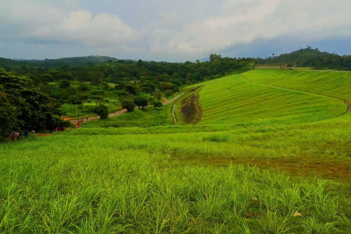
The dam is built as a homogeneous rolled earth fill structure, meaning there is no towering concrete wall here. What holds the reservoir is a vast compacted bank of earth and rock, faced with boulders and stepped along its outer slope. Because the ridge line around the reservoir dips in several places, a series of saddle dams closes those gaps, and a separate spillway structure handles overflow when the water rises to its limit.
| Specification | Value |
|---|---|
| Dam type | Homogeneous rolled earth fill |
| Height | 38.5 metres (126 feet) |
| Length | About 685 metres |
| River | Karamanathodu, a tributary of the Kabini |
| Gross storage capacity | 209.25 million cubic metres |
| Live storage capacity | 185 million cubic metres |
| Catchment area | 61.44 sq km |
| Reservoir surface area | 12.77 sq km at full reservoir level |
| Maximum water level | 775.60 metres |
| Operator | Kerala State Electricity Board, Padinjarathara station |
The floating solar array on the reservoir was an early experiment in mounting panels on water in India. Placing the array on the surface avoids taking up land and keeps the panels cooler, which helps output on hot afternoons.
The Reservoir, Islands and Landscape
The most recognisable feature of the site is not the dam wall but the water behind it. When the reservoir filled, it drowned the lower slopes of the surrounding hills and left their crowns exposed. The result is a scatter of small wooded islands sitting in open water, ringed by the darker green of the Ghats. Their number and size vary with the season, and a few disappear entirely when storage peaks.
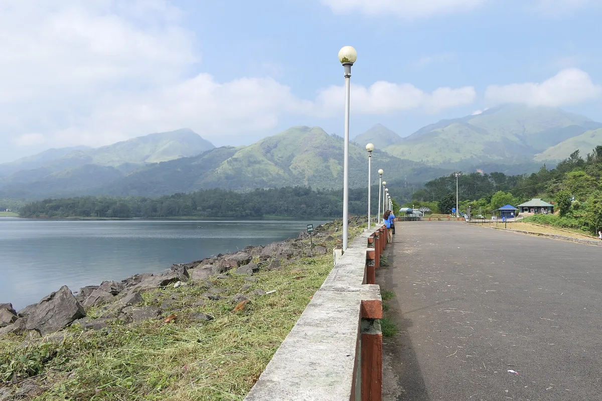
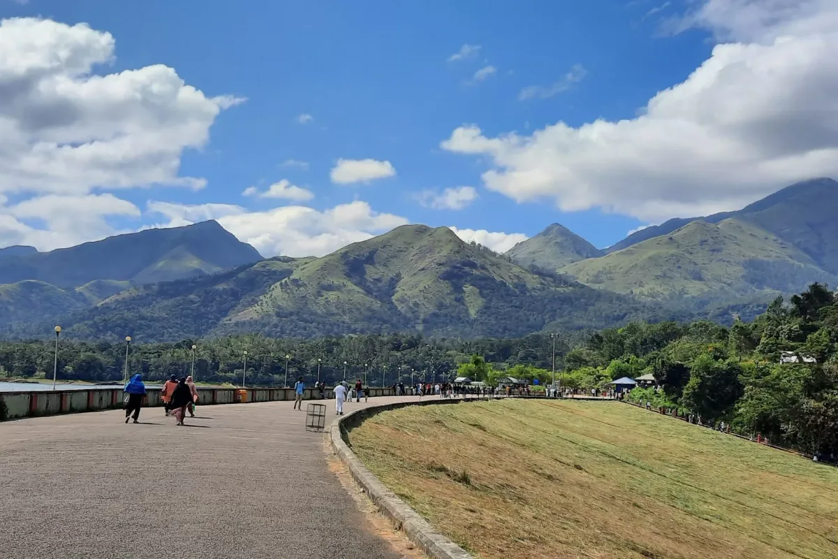
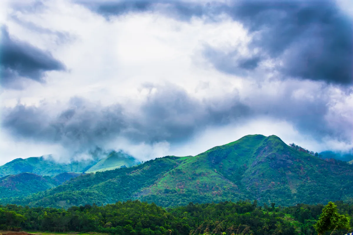
Banasura Peak rises behind the reservoir and forms the backdrop to most views from the embankment. Trekking routes climb toward the hill from the surrounding villages, and the grasslands and shola patches along the way are part of what makes this corner of Wayanad distinct from its plantation country. Closer to the water, herons, egrets, cormorants and kingfishers work the shallows, particularly in the cooler morning hours.
What the Landscape Offers
Post-monsoon greeneryIsland clustersGrassland ridgesMisty morningsOpen reservoir viewsSunset over the hills
Things to Do at Banasura Sagar
Boating on the Reservoir
Boating is the main draw. Speed boats run out toward the island cluster and back, covering the widest stretch of water in a short ride, while slower pedal and row boats stay closer to the shore for anyone who prefers a quieter circuit. Traditional round coracles are also offered at the site. Life jackets are mandatory for all passengers, and tickets are issued from the counter inside the park rather than at the water's edge.
Beyond the Water
The landscaped hydel park at the base of the dam, with lawns, walkways and picnic spots
A zipline running over part of the park grounds
The climb along the embankment to the viewing area at the top of the dam
Trekking routes leading toward Banasura Peak from the surrounding countryside
Birdwatching along the shallows and island fringes, best attempted early in the day
A fish spa within the park for a short break between activities
Private vehicles park in the lower zone, and reaching the dam from there means either a walk uphill or a ride on the shuttle bus that runs between the parking area and the dam site. Anyone travelling with young children or elderly family members should plan for the shuttle.
Visitor Information
Timings
The site generally admits visitors from 9:00 AM to 5:00 PM daily. Boating counters close well before the gate does, so arriving by mid afternoon is important for anyone hoping to get on the water. Weekends and holidays bring long queues at both the ticket counter and the boat jetty, and an early start is the simplest way to avoid them.
Charges
| Category | Approximate Charge |
|---|---|
| Adult entry | ₹40 |
| Child entry | ₹20 |
| Camera | ₹40 |
| Vehicle parking | ₹40 |
| Shuttle bus, one way | ₹15 |
| Shuttle bus, return | ₹25 |
| Zipline | ₹300 to ₹400 per person |
| Boating | Varies by boat type and number of passengers |
Ticket rates and boating charges are revised from time to time and differ between boat categories, so the figures above should be treated as an indication rather than a fixed price list. Confirming current rates at the counter is advisable.
Best Time to Visit
October through February brings the most comfortable conditions, with cool air, clear skies and a reservoir still holding post-monsoon levels. March to May turns warm around midday, which makes early morning and late afternoon the sensible slots. The monsoon months deliver the greenest landscape and the fullest reservoir, though rain can interrupt boating and outdoor activity at short notice.
Heavy rainfall in the hilly parts of Wayanad raises the risk of landslides during the monsoon. Checking local weather advisories and IMD alerts before travelling, and skipping trekking during active warnings, is strongly recommended.
Image Gallery
Summary
Banasura Sagar Dam at Padinjarathara is the largest earthen dam in India, built across the Karamanathodu river in Wayanad
The reservoir supports the Kakkayam hydroelectric project through the Kuttiyadi Augmentation Scheme, along with irrigation and drinking water supply
Submerged hill tops form a cluster of small islands that change in number and size with the season
Boating, a zipline, the hydel park and trekking routes toward Banasura Peak make up the main activities
Entry costs around ₹40 for adults and ₹20 for children, with separate charges for parking, camera, shuttle and boating
October to February offers the most comfortable weather, and an early arrival avoids the worst of the queues
Banasura Sagar Dam combines a sizeable piece of Kerala's water infrastructure with one of the more photogenic reservoir landscapes in the Western Ghats. It pairs naturally with other stops in the same district, and travellers building a wider route can look at guides for Chembra Peak and Karapuzha Dam when planning the rest of the trip.
Nearby Hotels/Resorts
Nearby Attractions
Frequently Asked Questions
Where is Banasura Sagar Dam located?
Banasura Sagar Dam is at Padinjarathara in Wayanad district, Kerala, roughly 21 kilometres from Kalpetta. It is built across the Karamanathodu river, a tributary of the Kabini, at the foot of the Banasura hills.
What are the Banasura Sagar Dam timings?
The site is generally open daily from 9:00 AM to 5:00 PM. Boating counters stop issuing tickets well before closing time, so arriving by mid afternoon is important for anyone planning a boat ride.
What is the entry fee for Banasura Sagar Dam?
Entry costs around ₹40 for adults and ₹20 for children. Parking, camera use, the shuttle bus, the zipline and boating are charged separately, and rates are revised periodically, so confirming current prices at the counter is advisable.
Is boating available at Banasura Sagar Dam?
Yes. Speed boats, pedal or row boats, and traditional coracles operate on the reservoir. Charges depend on the boat type and the number of passengers, and life jackets are mandatory for everyone on board.
Why is Banasura Sagar Dam famous?
It is the largest earthen dam in India and the second largest in Asia, built from compacted earth and rock rather than concrete. The reservoir is also known for the cluster of small islands formed by submerged hill tops, set against the Banasura hills.
What is the best time to visit Banasura Sagar Dam?
October through February offers the most comfortable weather, with cool air and a reservoir still holding post-monsoon levels. Monsoon months bring the greenest scenery but rain can interrupt boating and outdoor activities.
Reviews
No reviews yet!
Recent Stories
Tech Travel
En Ooru, Wayanad: Ticket Price, Timings and Booking Guide
30 September 2026 Tech
TechGPT-6 Astra: Overview, Features, Pricing and Competitor Comparison
25 September 2026 Travel
Pookode Lake, Wayanad: Timings, Entry Fee, Boating and Visitor Guide
29 August 2026 Travel
Soochipara Waterfalls, Wayanad
29 August 2026 Travel