


 Tech
Tech
Edakkal Caves | Wayanad, Kerala
Edakkal Caves in Wayanad holds Neolithic petroglyphs on Ambukuthi Hill. Timings, entry fee, best season, the climb and the conservation picture.
29 August 20269 min read
Edakkal Caves at a Glance
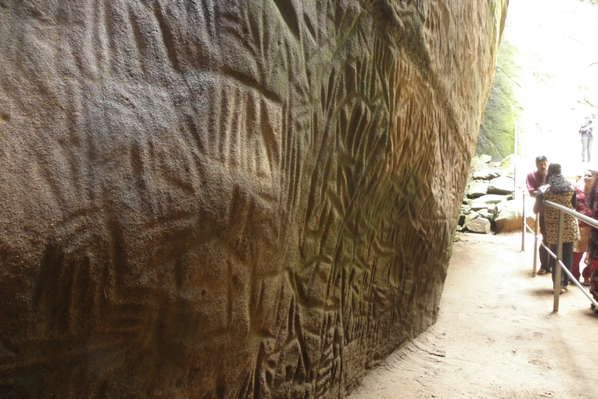
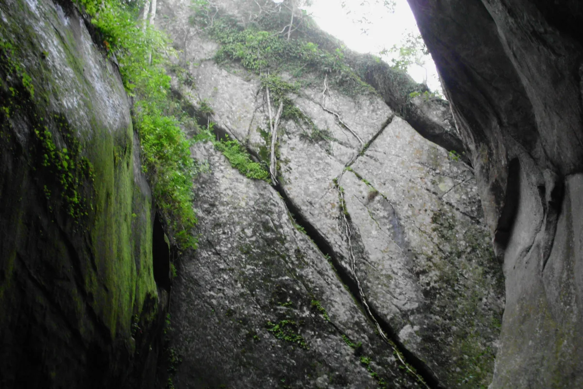
Edakkal Caves sit on the western slope of Ambukuthi Hill in the Nenmeni area of Sulthan Bathery taluk, Wayanad district, Kerala, at roughly 1,200 meters above sea level. Despite the name, the site is not a cave system in the usual sense. It is a deep cleft in a single rock mass, about 96 feet long and 22 feet wide, with the fissure dropping more than 30 feet. A separate boulder wedged across the top forms a natural roof, and that is where the local name comes from, since Edakkal translates roughly as a stone lodged in between.
What gives the shelter its standing is not the geology but the walls. Rock engravings cover large parts of the interior surfaces, and the oldest of them are estimated at more than 8,000 years. Together with the Mesolithic rock art of the Shenthurini forests in Kollam district, these are the only prehistoric engravings of their kind documented anywhere in South India. The site was notified as a protected monument in 1985 and falls under the Kerala Department of Archaeology.
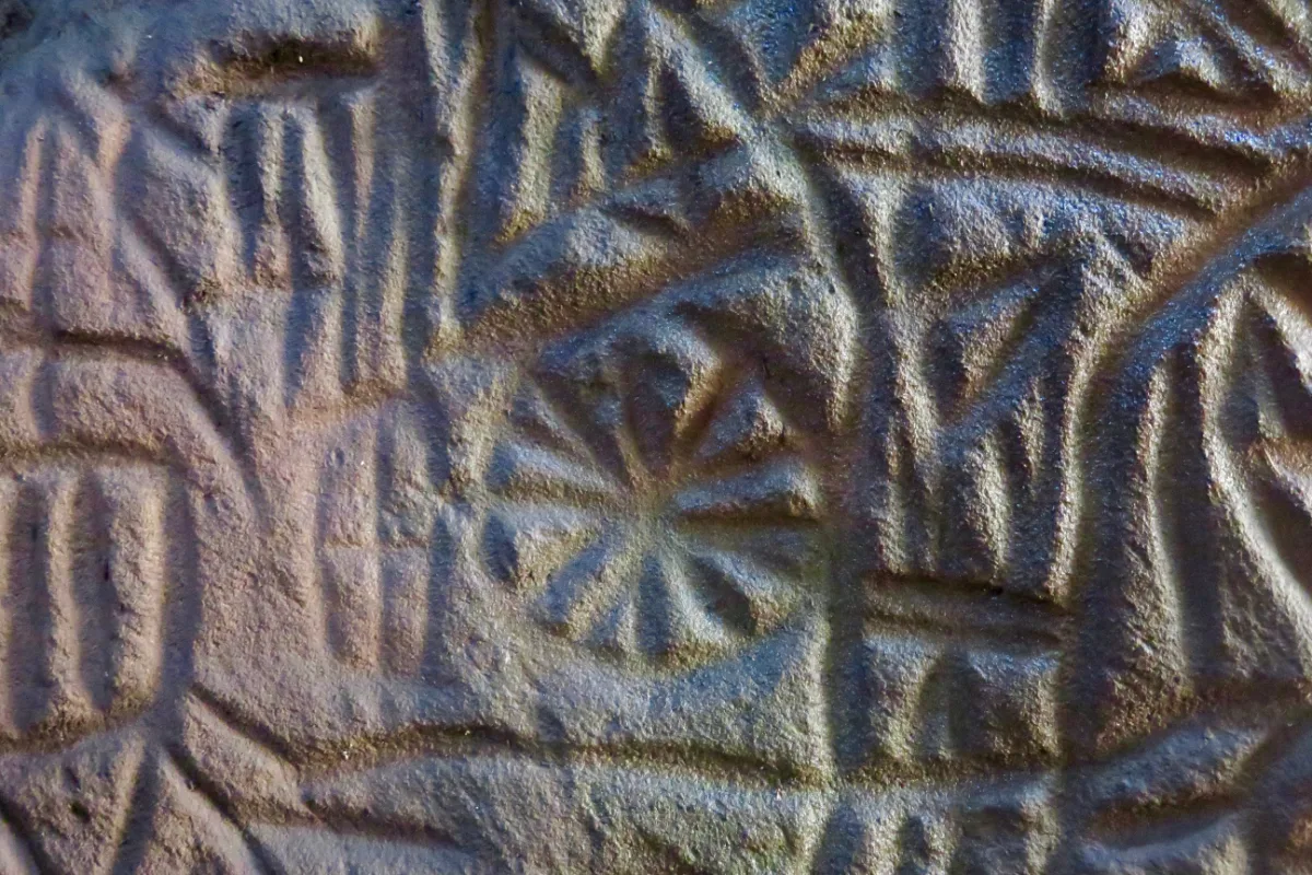
The markings at Edakkal are petroglyphs, meaning they were cut into the rock rather than painted onto it. Older write-ups that describe them as cave paintings are using the term loosely.
Site summary
| Detail | Value |
|---|---|
| Location | Ambukuthi Hill, Nenmeni, Sulthan Bathery taluk, Wayanad |
| Elevation | About 1,200 m above sea level |
| Formation | Rock cleft roughly 96 ft long, 22 ft wide, over 30 ft deep |
| Age of oldest carvings | Estimated at more than 8,000 years |
| Documented by | Fred Fawcett, 1890 |
| Protected status | Notified as a protected monument in 1985 |
Formation, Discovery and Local Legend
How the shelter took shape
The cleft formed when a section of the outcrop separated from the main rock body, leaving two facing walls with a gap between them. Several tons of rock came to rest across the opening instead of falling through, which produced the sheltered chamber that survives today. The hill also stood close to an old overland route that linked the Mysore plateau with the trading ports of the Malabar coast, which helps explain why groups from very different periods passed this way and left marks behind.
Documented in 1890
Fred Fawcett, then Superintendent of Police for the Malabar district, came upon the shelter in 1890 during a hunting trip through Wayanad. He understood at once that the engravings were of anthropological value and later published an account in the journal Indian Antiquary, which is what drew scholars to the hill. Systematic study has continued in stages ever since, and the interpretation of several motif groups is still open.
Stories attached to the hill
Local tradition offers its own explanations for the split rock, and both are still repeated on the trail.
One account holds that Lava and Kusha, the sons of Rama, split the hill with arrows, which is offered as the origin of the name Ambukuthi, a reference to being pierced by an arrow.
Another ties the shelter to Kutti Chathan and the goddess Mudiyampilli, and villagers once climbed the hill on pilgrimage to worship there.
What the Engravings Show
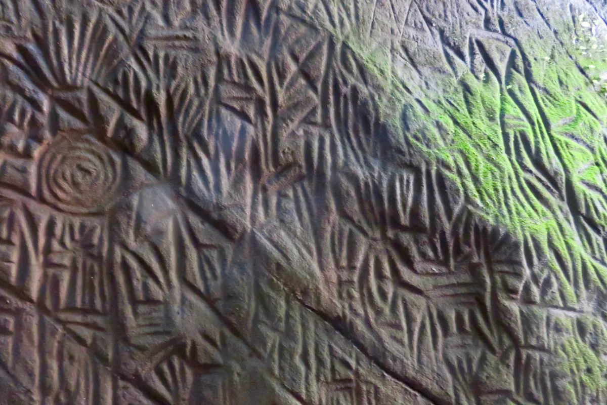
Researchers have identified at least three distinct groups of engravings on the walls, and they do not belong to one moment. The main Neolithic layer is placed around 6,000 BCE, with later additions running down to roughly 1,000 BCE. That spread points to repeated use of the shelter across long gaps rather than a single continuous settlement, and the differences in cutting technique between the groups are visible even to a casual visitor.
Motifs recorded on the walls
| Motif group | Examples found at the site |
|---|---|
| Human figures | Figures with elaborate headdresses, ornamented figures, masked faces, a conical figure, a figure seated in a wheeled cart |
| Animals | An elephant, a peacock, a pair of wild dogs, other quadrupeds |
| Objects and transport | Wheeled carts, hand tools, weapon shapes |
| Abstract signs | Triangles, squares, stars, crosses, tridents and other geometric marks that remain undeciphered |
| Inscriptions | Short texts in more than one ancient script, cut later than the figurative work |
Taken together the imagery suggests a community that hunted and also worked the land, with enough social structure to mark rank through headgear and ornament. Around 400 individual signs have been catalogued so far. An iron railing now runs in front of the engraved surfaces to keep visitors from touching them, and portable artefacts recovered from the hill are held at the Wayanad Heritage Museum in Ambalavayal rather than at the site itself.
Light inside the shelter is uneven and the rock face is often damp, so many of the finer marks only become legible once the eye adjusts. Allow time rather than passing straight through.
The Indus Valley Question
In September 2009, historian Raghava Varier of the Kerala archaeology department drew attention to a motif at Edakkal described as a man with a jar cup. The figure was read as resembling a sign familiar from Harappan material more closely than comparable examples reported from sites in Tamil Nadu and Karnataka. The claim reframed the shelter as possible evidence that Harappan cultural forms travelled much further south than the Indus basin.
The epigraphist Iravatham Mahadevan, who worked extensively on the Indus script, treated the identification as significant. The wider argument runs that the Indus civilisation did not simply vanish but dispersed, carrying elements of its visual vocabulary into other regions through contact and trade. Edakkal, sitting on an old route between plateau and coast, fits that picture geographically.
The Harappan reading is one interpretation and not a settled conclusion. No inscription at Edakkal has been deciphered as Indus script, and many of the abstract signs still have no agreed meaning.
Pressures on Ambukuthi Hill
The hill carries a heavier load than the engravings alone. During the intense rainfall of 2019 a crack opened along roughly 60 meters of the eastern slope, and a district soil conservation team inspected the ground without settling on a single cause. Wayanad has seen repeated extreme rainfall and landslides since 2018, and fissures of that kind are exactly what turn a saturated slope into a slide. The first chamber has been shut to visitors for months at a stretch during bad monsoon spells.
The main threats
Water moving steadily across the rock face, which wears the surface and can loosen sections over time
Vegetation taking root in the cracks, widening them and obscuring the carved panels
Quarrying near the hill, including blasting, which sends vibration through the rock mass
Resort and building work inside the restricted zone, often approved as small structures and then expanded
Concentrated visitor traffic on a slope that has no alternative route
About 5.5 acres around the shelter is protected land and construction is barred within 300 meters of it, but conservation groups in Wayanad argue that enforcement has not kept pace. Their demand is that the Archaeological Survey of India take charge of the whole hill so that interference stops at the boundary rather than at the monument. A transfer to the state archaeology department was announced years ago and has moved slowly. Efforts to secure UNESCO World Heritage listing have run for over a decade, and supporters argue the designation would protect the ecological balance of the slope as much as the carvings.
Slope stability is not only a heritage concern. Settlements at Kuppakolli, Edakkal, Andikavala, Vellachatta, Pattiyambam and Govinda Moola sit on the same hillsides, and hundreds of families there carry the consequences of any large failure.
Image Gallery
Planning a Visit
Best months
September to February is the practical window. The air is cool, the rock steps are dry enough to trust, and visibility from the upper slope is at its best. Through the heavy monsoon the path and the stone stay slick, footing becomes unreliable, and the site closes without much notice when landslide risk rises. In the hot months the open stretches of the climb drain most visitors before they reach the top. Weekdays are noticeably quieter than weekends and public holidays.
Timings
Open from about 8:30 AM to 4:00 PM
Ticket sales stop well before closing time
Closed every Monday and on national holidays
Daily ticket numbers are capped, and on weekends and holidays passes can run out around midday. Arriving early is the reliable way in. Timings shift occasionally, so confirm before setting out during the monsoon.
Entry fee
| Category | Fee |
|---|---|
| Adult | Rs 50 |
| Child below 12 years | Rs 30 |
| Still camera | Rs 50 |
| Video camera | Rs 200 |
| Parking | Rs 20 |
Charges are revised from time to time and are collected at the counter on the hill, so treat these figures as indicative rather than fixed.
The climb
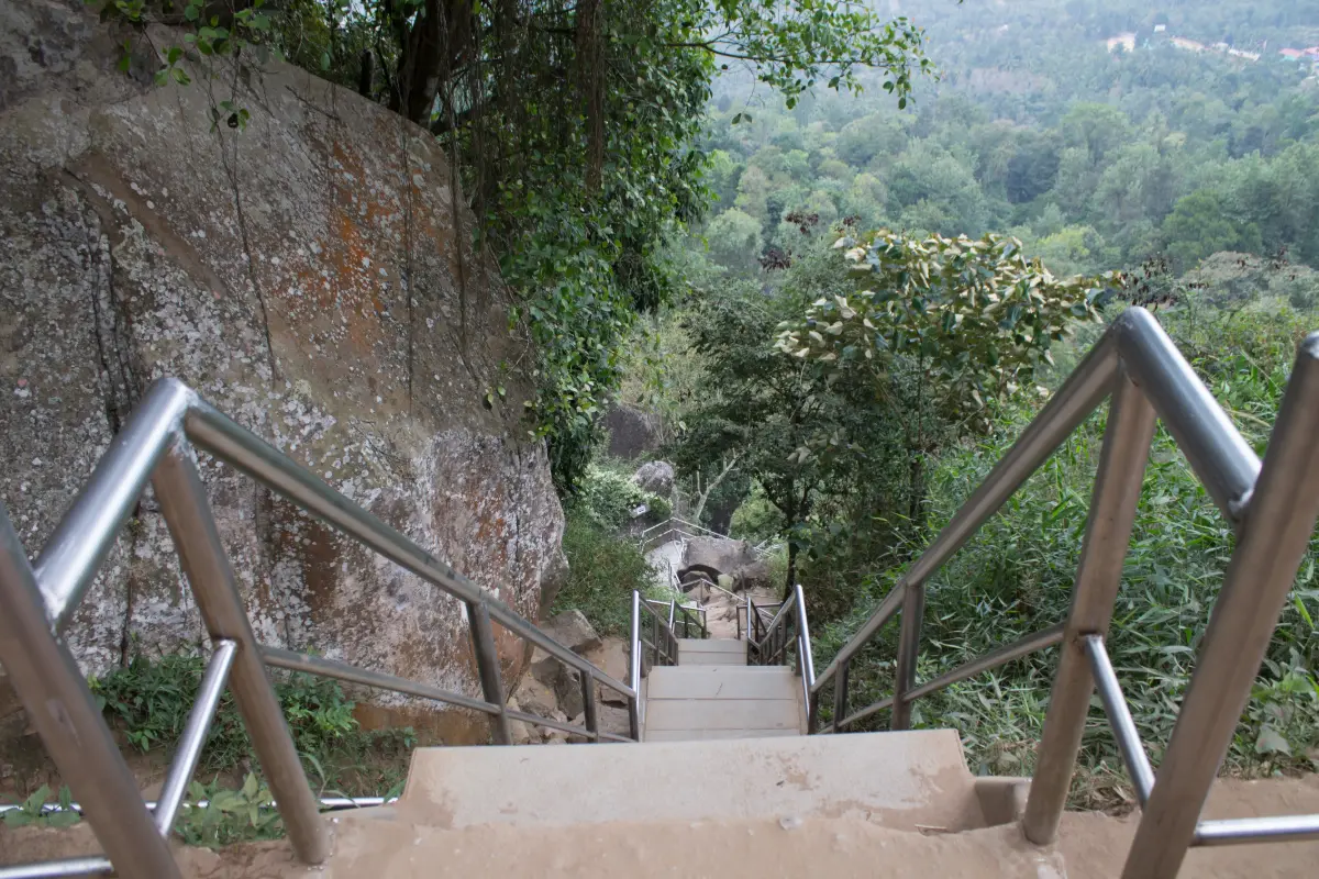
The ascent begins at the parking area and runs roughly 1.5 km to the shelter, which most visitors cover in 45 minutes to an hour at an unhurried pace. A jeep service operates over part of the slope for those who want to shorten the walk. The gradient tightens near the top, where the route turns into stone steps and steel stairways bolted to the rock. Small stalls along the lower stretch sell water and snacks and double as rest points, and the path runs through coffee plantations for much of the way.
Practical tips
Shoes with a firm grip matter more than anything else, since the rock stays damp even outside the rains.
Start early in the morning for cooler air, thinner crowds and better light on the carvings.
Carry water; stalls thin out on the upper section of the trail.
Keep food packets out of sight, as the macaques along the path will take anything visible.
The final flight of steps is steep and narrow, which makes it hard going for elderly visitors and anyone carrying an infant.
The Wayanad Heritage Museum at Ambalavayal holds material recovered from the hill and pairs naturally with the same day.
Photography
Photography is allowed on payment of the camera charge, though the conditions are demanding. The chamber holds shade and moisture, the engraved surfaces are shallow, and direct flash tends to flatten them. Raking light in the early hours picks out the cut lines far better. From the ledge outside, the view opens across the plantations and ridges of the surrounding valley, and a telescope installed at the top extends it further on clear mornings.
Summary
Edakkal is a short visit with a long reach. The walk takes an hour, the shelter itself is a single chamber, and the whole stop fits comfortably into half a day. What stays with visitors is the compression of time on those two walls, where marks cut across several thousand years sit within arm's length of each other. The site rewards patience more than speed.
Neolithic petroglyphsAmbukuthi HillProtected monument since 1985Closed MondaysSeptember to February45 to 60 minute climbWayanad Heritage Museum nearby
Anyone planning a trip during or shortly after the monsoon should check the current position on the ground before committing to the day, since closures on this slope are decided at short notice and for good reason.
Nearby Hotels/Resorts
Nearby Attractions
Frequently Asked Questions
What are the Edakkal Caves and why do they matter?
Edakkal is a rock shelter on Ambukuthi Hill in Wayanad, Kerala, formed by a deep cleft in a single rock mass with a boulder resting across the top. Its walls carry prehistoric engravings, some estimated at more than 8,000 years old, which makes it one of only two documented sites of prehistoric rock art in South India. It has been a protected monument since 1985.
How old are the carvings at Edakkal Caves?
The oldest engravings are estimated at over 8,000 years. The principal Neolithic layer is placed around 6,000 BCE, with later additions continuing down to roughly 1,000 BCE. At least three distinct groups of carvings have been identified, which indicates the shelter was used repeatedly across long intervals rather than occupied continuously.
What are the Edakkal Caves timings and entry fee?
The site is generally open from about 8:30 AM to 4:00 PM and is closed on Mondays and national holidays. Entry is around Rs 50 for adults and Rs 30 for children below 12, with Rs 50 for a still camera, Rs 200 for a video camera and Rs 20 for parking. Charges are revised occasionally, and daily ticket numbers are capped, so passes can run out by midday on busy days.
How difficult is the climb to Edakkal Caves?
The ascent runs roughly 1.5 km from the parking area and takes most visitors 45 minutes to an hour. The lower section is a graded path through coffee plantations, while the final stretch becomes steep stone steps and steel stairways. Footwear with a good grip is essential, and the last flight is hard for elderly visitors and anyone carrying a small child.
When is the best time of year to visit Edakkal Caves?
September to February offers the most comfortable conditions, with cool air, dry steps and clear views from the upper slope. The monsoon leaves the path and rock slippery and the site can close at short notice because of landslide risk, while the hot months make the open sections of the climb tiring.
Is there a link between Edakkal and the Indus Valley Civilisation?
A motif described as a man with a jar cup, identified at Edakkal in 2009, was read as resembling a Harappan sign, which raised the possibility that Indus cultural forms reached this far south. The interpretation was treated as significant by scholars of the Indus script, but it remains a proposal. No inscription at the site has been deciphered as Indus script and many of the abstract signs are still unexplained.
Reviews
No reviews yet!
Recent Stories
Tech Travel
En Ooru, Wayanad: Ticket Price, Timings and Booking Guide
30 September 2026 Tech
TechGPT-6 Astra: Overview, Features, Pricing and Competitor Comparison
25 September 2026 Travel
Pookode Lake, Wayanad: Timings, Entry Fee, Boating and Visitor Guide
29 August 2026 Travel
Banasura Sagar Dam, Wayanad: A Complete Travel Guide
29 August 2026 Travel