


 Travel
Karapuzha Dam, Wayanad: A Complete Travel Guide
Explore Karapuzha Dam in Wayanad, Kerala: its history, engineering, gardens, birdlife, entry fees, and the best time to visit this scenic reservoir.
29 August 20265 min read
Karapuzha Dam: An Overview
Karapuzha Dam stands in Wayanad district, Kerala, on the banks of the Karapuzha River, a tributary of the Kabani River. Building work began in 1977 and wrapped up in 2004, resulting in one of India's largest earth dams. Irrigation was the primary goal behind its construction, and canal extensions on both banks remain an ongoing effort.
In the years since, the reservoir has grown into a recognized leisure spot for Wayanad visitors. Landscaping and recreational upgrades carried out between 2019 and 2021 under the Karapuzha Mega Tourism initiative turned the dam surroundings into gardens, boating areas, and open spaces that now draw a steady stream of visitors.
History and Purpose
Project Background
Officially termed the Karapuzha Medium Irrigation Project, this scheme was the first medium scale irrigation effort sanctioned within the Kabani sub-basin of the interstate Kaveri river network. The Karapuzha river, sometimes called Thoth, rises in the Western Ghats within Wayanad and feeds into the Kabani. Kerala's share of Kaveri waters under the Cauvery Water Disputes Tribunal totals 30 TMC, of which 21 TMC is earmarked for the Kabani sub-basin entirely inside Wayanad district. Roughly 2.80 TMC of that allocation supports the Karapuzha scheme.
Project Timeline
- 1974: Groundwork for the project got underway
- 1978: Kerala's government and the Planning Commission cleared administrative approval, budgeted then at around Rs. 7.60 crore
- 2004: The completed dam went into operation
- 2017: State authorities cleared a revised project report valued at Rs. 560 crore
Pending land acquisition across parts of the reservoir zone currently caps water storage near 758.45 MSL, short of the designed full reservoir level of 763 MSL.
Engineering and Geography
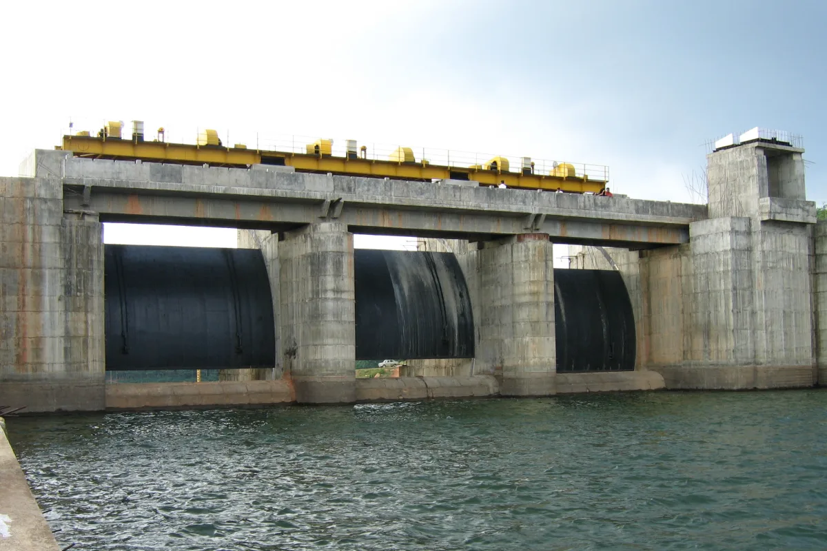
Positioned at Vazhavatta within Wayanad's Vaithiri taluk, the structure combines an earthen embankment with a concrete spillway section. Its irrigation command spans roughly 5,600 hectares spread across Vaithiri, Sultan Bathery, and Mananthavadi taluks. Three radial gates, each 10 by 6 meters, regulate spillway flow, while a steel conduit channels water into a diversion chamber that feeds the left and right bank canal networks. Present day coverage stands near 3,486 hectares on the left bank and 2,114 hectares on the right.
| Specification | Value |
|---|---|
| Height | 28 meters (92 feet) |
| Length | 625 meters (2,051 feet) |
| Live storage capacity | 72 MCM (2.54 TMC) |
| Gross storage capacity | 76.5 MCM |
| Catchment area | 62 sq km |
| Surface area | 8.55 sq km |
| Spillway discharge capacity | 969 cubic meters per second |
| Coordinates | 11.618243, 76.172215 |
Piped drinking water from the project already serves Kalpetta Municipality and Meenangadi Panchayat, while connections for Sultan Bathery, Nulpuzha, Mutil, Meppadi, Moopainad, and Vaithiri panchayats remain under construction.
Tourism and Attractions
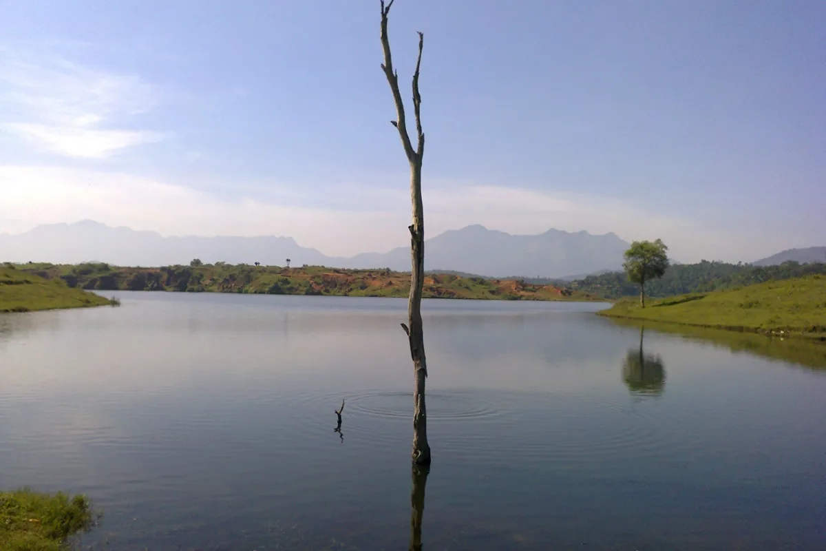
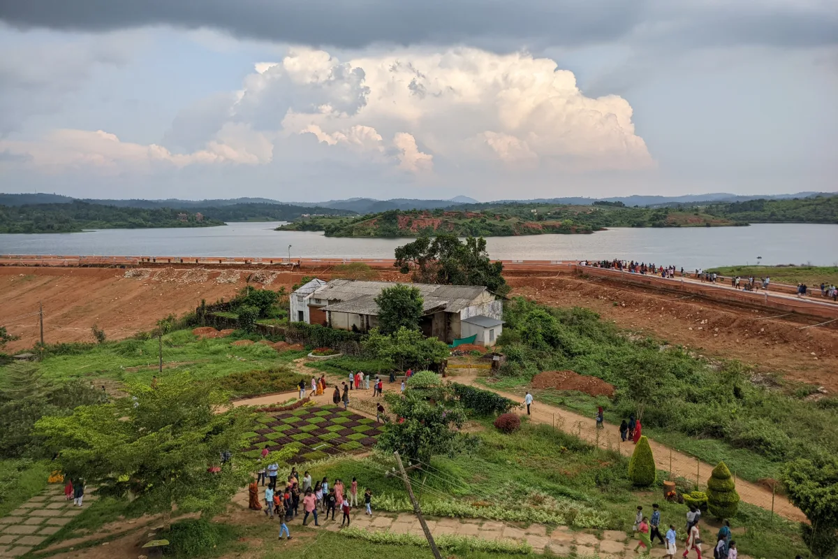
Grounds around the reservoir have been shaped into a landscaped park, complete with footpaths and open lawns that trace the water's edge. A viewing tower gives a wide angle look at the dam basin, and on clear days Chembra Peak and Ambukuthi Mountain rise on the horizon. Partially submerged islets scattered through the catchment area draw water birds, which in turn draw birdwatchers and photographers to the banks.
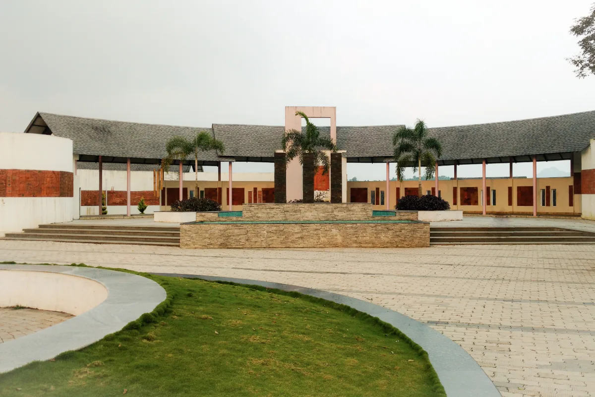
Manicured gardens and a paved walkway leading from the main gate
An elevated watchtower overlooking the reservoir and nearby peaks
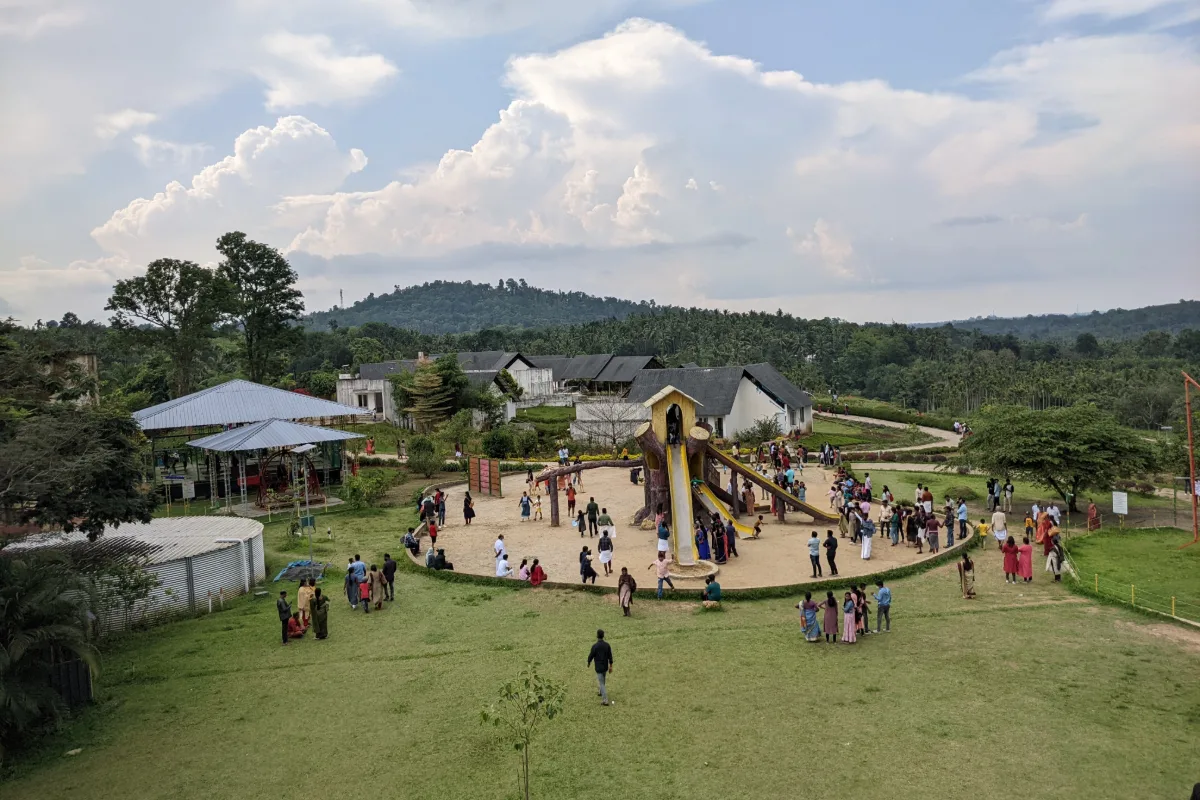
A children's play zone with swings, slides, and games
Boating available directly on the reservoir
Islets and shallows that attract resident and migratory water birds
Fishing communities living near the reservoir continue a tradition of coracle fishing, working nets and lines from small round boats. Sitting just off the Kalpetta-Sultan Bathery stretch, the site does not call for any trekking to reach its viewing areas, which keeps it approachable for visitors across age groups.
Birdlife and Photography
The mix of open water, partially submerged hillocks, and green islets gives Karapuzha Dam a distinct character among Wayanad's water bodies. Wetland and resident birds frequent the shallows, particularly during the cooler months, which makes early morning visits worthwhile for anyone carrying a camera or binoculars.
Evenings tend to draw the largest crowds, when the sun sets over the western hills and casts color across the reservoir surface. During the monsoon months, water levels rise close to the embankment, changing the look of the site considerably compared with the drier season.
Photography and videography carry separate charges beyond the standard entry fee, covering still cameras, video cameras, and outdoor shoots.
Visitor Information
Timings
The site admits visitors from 9:00 AM to 6:00 PM daily. Reaching the grounds by around 4:30 PM leaves enough time to walk through before closing.
Entry Fees
| Category | Fee |
|---|---|
| Adults | ₹30 |
| Children | ₹10 |
| Still camera | ₹50 |
| Video camera | ₹200 |
| Outdoor shooting | ₹500 |
Best Time to Visit
Visits are possible year round, though the December to February window offers the most comfortable conditions thanks to cooler temperatures. Scheduling a visit for morning or late afternoon avoids the sharper midday sun.
Heavy rainfall in Wayanad's hilly regions can raise the risk of landslides during the monsoon season. Checking local weather advisories and IMD alerts before planning a trip, and avoiding trekking or hiking activities during active warnings, is recommended.
Image Gallery
Summary
Karapuzha Dam ranks among India's largest earth dams, built mainly to support irrigation across Wayanad district
The Karapuzha Mega Tourism area adds gardens, a watchtower, boating, and birdwatching to the reservoir setting
Entry fees stay modest, from ₹10 to ₹500 depending on category and camera equipment
December through February brings the most comfortable visiting conditions
Early mornings and evenings suit birdwatching and photography best
Karapuzha Dam pairs engineering history with a quiet, scenic setting, making it a worthwhile stop for travelers exploring Wayanad's natural and cultural landmarks alongside sites such as Edakkal Caves and Chembra Peak.
Nearby Attractions
Frequently Asked Questions
Reviews
No reviews yet!
Recent Stories
Travel Travel
Banasura Sagar Dam, Wayanad: A Complete Travel Guide
29 August 2026 Travel
Soochipara Waterfalls, Wayanad
29 August 2026 Travel
Edakkal Caves | Wayanad, Kerala
29 August 2026 Travel
Kuruva Island (Kuruvadweep), Wayanad: Complete Visitor Guide
29 August 2026 Travel